Saturday, September 29, 2012

September 29, 2012 - Horse Creek Trail

Esther and I very much want to get back into our very long walks that we were doing up until around May of this year. The long walks are undeniably good for the two of us: we lose weight, we talk (to each other, not just at each other), we take pictures and we see new places and new things. It helps us work. At the height of our walks we hit 26 miles on the Richard-Martin trail and we were making 12 and 14 mile treks on a regular basis- all while taking short 4 and 6 mile loops on our local walking tracks during the week.

Today we explored a rails-to-trails segment that runs between Dora and Sumiton. Esther found this while we were both hunting down significant hikes in the area that were closer than two hours away and that we haven't done. The path is paved with the exception of northern most tip that runs under Old Highway 78 and into Sumiton that is not more than mowed tire tracks in the ground. This section of the trail could honestly be skipped as it's behind several houses and really feels more like your just walking through backyards with large barking dogs on chains.


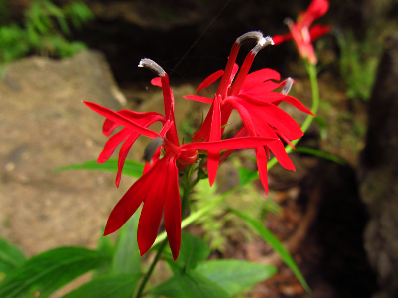
There were Fall wild flowers on the embankment to the side of the trail. Esther doesn't know Autumn blooms as well as Spring ones and I certainly have no clue what they were, but I've made some bold guesses below:


A purple flower

A different purple flower

Not a purple flower
There were a couple of persimmon trees dropping over-ripe fruit on the trail. Esther found one that wasn't ker-splooshed on the asphalt. It was still a little gelatinous feeling and neither of us tried it. 


At a little more than the half-way point along the trail is a spur that climbs a steep hill. This spur looked nothing like the rest of the trail and although we passed it by the first time, on the way back we huffed and puffed up the hill to see what there was to see.


Steep is so hard to photograph
At the top of the hill is the Dora Municipal park to which the spur joins the circular walking track to the trail. It was a nice change of pace but we felt a little weird with our backpacks and sweaty hiking gear walking around the baseball field. My knee protested the slope on the way back down but I found that if I walk backwards (holding Esther's hand for balance) it's not bad at all.

In total the hike was a little over 6.5 miles (and two geocaches) long. I don't think it's at the top of our list, but it will be a good option to have as we get back into the habit of our long walks.

Tracklog- here.
Pictures- here.


I leave you with these two pictures from the day. One we found trying to locate the trail-head and found ourselves behind a local school near the dumpsters. The other we saw at a red light in Sumiton.


2 points for homeschooling


Monday, September 24, 2012

September 22, 2012 - First day of Autumn, Cane Creek Canyon

Few other places would I prefer to spend the first day of Autumn than in Cane Creek Canyon. We slept more or less okay; the sound of acorns crashing through the trees, my stuffy-nose snoring, the bright flicker of the fire and the bright half-moon took turns waking one or more of us through the night. For me, at least, it was an improvement over the previous night's rest.

With everybody up, we dined on grits and trail mix before relocating near the Lacefield's house for a bit to welcome any early morning hikers.

Welcome bear welcomes you

Ben and I took a turn trail-sitting while Esther and Chan drove Jake over to a nearby friend's house to stay for a few days. I directed a few unknowing first-timers with small children to their imminent doom, but otherwise it was a uneventful and relaxing.


The girls returned sans one Jake and took a spell guarding the gates to the canyon while Ben and I went for a hike and I hunted out one of the many geocaches on the property that I haven't yet found.

Red-vested monkey


Funnel web spider


Upon our return we found Esther had taken up a new hobby- kite spinning. I think the long underwear under the dress is optional, but I've been wrong before.


After awhile more hikers appeared, some on their first visit others walking familiar trails. We directed them to the maps and pointed out some of the best spots, showed them where on the map they could find water if they didn't bring enough of their own and answered questions about Lacefield's cats.

Sometime around 5:30 we packed up our bags and (with the help of a frog or two) rolled up the tents and headed for home.


All the pictures are here.
The tracklog of my hike with Ben is here.

Friday, September 21, 2012

September 21, 2012 - Where's My Luggage?

Today starts out with me waking up in a hotel on the backside of Detroit, courtesy of Delta Airlines. The previous day had been one plane delay after another; first for bad weather that did not exist, later for parts that would not arrive and lastly for pilots that did not want to spend the night in Alabama. Word amongst our fellow castaways was that there was some mini-protest thing with the pilots for American or United and in a show of solidarity, their brothers at the other airlines were taking similar actions.

Whatever the reasons, at 7PM in Detroit I was riding in the back of the shuttle (a retrofitted van) bumping along in the dark with four similar pieces of paper: two $6 food vouchers, a hotel room voucher and a "seating request" for a flight in the morning to get me back home. Fortunately the pizza place down the road accepted the vouchers and after combining some of mine with my travel partner's (and $1.70 in change) we were able to feast on pizza, wings and crazy bread. There was a $50 taxi ride to Walmart for supplies too, but the best part was waking up the next morning and putting the whole thing behind me.


After a quick stop at the house to unload my suitcase and re-load my backpack we left out for a night of camping at Cane Creek Canyon. It was our camping trip at this same location in April of 2011 that started this blog. The property owners, the Lacefields, had asked us to keep an eye on things and greet the campers and hikers that arrived Friday night and Saturday morning through the afternoon. Considering that everything the canyon has to offer is completely free, we were more than happy to give back and help them out in any way possible. 

We arrived a few hours before sunset and had plenty of time to make a short hike to the first waterfall and the overlook.


As a half-moon night covered us in darkness we cooked turkey franks and s'mores over the fire.


After our meal we retired to the tents. Well most of us... Jake opted for the hammock and slept in the open, completely unprotected from werewolves, rabid raccoons, and any number of other dangers.


Yes, sunglasses and a toboggan
Esther and I wandered around in the dark for a bit before snuggling up in our tent. She picked up these satin sheets called the "Dreamie" (from the maker of the Snuggie) because she's read about how well they keep you warm without the bulk of a sleeping bag. We had both our mummy bags and the Dreamie and I was plenty warm sleep under just the Dreamie all night with the temps dropping to the low 50's. Silly name, but they work.


Consider where I started the day and were I ended it, I much preferred the later over the former. 

All the pictures from the day are right here.

Saturday, September 15, 2012

September 15, 2012 - Brushy Creek and Sougahoagdee Falls

Today's hike was in another section of Bankhead that we really haven't explored much. We've driven by the trail head, but this was our first time to hike the trail. This trail is not as well maintained as others and at a couple of points along the way we had to make our best guess before picking up the path again. Most of the way is on what looks like an old logging trail but you have to leave that and find the footpath more than once. Still this was an enjoyable trip. Along for the walk was our newly adopted little brother, Marc, that we met while the kids and I were doing theater together. Marc came with his dog, "Spotty".

The pictures are in no particular order, starting with the flowers that I don't know what they are. Esther thinks the second one is some kind of cardinal flower.


Spotty considers the log bridge...


...then makes her own way across the creek


The trail ends for the most part at Sougahoagdee Falls.


While the falls were nice, the possible high point of the trip was seeing the first venomous snakes of the year! We've come across maybe twenty or thirty snakes this year and these are the only two that could have caused us some serious harm. The rattler was about a foot and a half in length and the copperhead was a respectable three feet long. Marc spotted the rattler from the trail and thought it was a feather at first. You can see how it stands out a little from the leaves on the ground. The copperhead, however... well, just back away from your monitor a little bit and see how easily it blends into the forest floor. I had already walked past it, Marc probably stepped over it and it wasn't until Esther almost walked right through it (followed by a loud expletive) that any of us knew it was there.


Unlike the water snakes we saw last week, this was undoubtedly a copperhead. Vertically slit pupils, flat angular head, and the dark bands that are thicker near the belly clearly identify it as the venomous snake.


Tracklog of our hike is here.
All the pictures can be found here.

Sunday, September 9, 2012

September 9, 2012 - Cedar's of Lebanon, Murfreesboro, Barfield Crescent


For the last two nights we have been camping at Cedars of Lebanon State Park in our pop-up. Our last day of our trip, I started it by running out and finding an older geocache that was hidden in 2001 just off a nearby trail.


After everybody was up and fed we went back down the trail with our friends to explore the sinkholes that our kids used to climb down eight years ago.


The big nose tree


We split off from the group for a bit to grab lunch and a quick hike in Murfressboro starting at Canonsburgh Village and taking the greenway to Sal y Limon Mexican Resturant.


World's Largest Cedar Bucket- gaze in awe


Familiar graffiti


We reconnected at Barfield Crescent Park where we hiked around a bit, played some Frisbee golf and encountered several water snakes in the creek.

Some of you may be looking at these pictures and you're now screaming COPPERHEAD RUN FOR THE HILLS!!! I assure you, these are not copperheads but are in fact harmless water snakes. How do I know this? Two things- the rounded pupils and the shape of the dark bands. Water snakes have a saddle-shaped dark band that it thicker near the spine and thinner near the belly. The dark band on copperhead is reversed- thinner near the spine and thicker near the belly of the snake. 

I tried to make up several memorable little rhymes to help me remember this difference- much like the "Red on yellow, kill a fellow"; "Red on black, friend of Jack" for king snakes and coral snakes. The best I could come up with was "saddle like a horse, friendly of course" and "hour-glass bands, bite you on the hand". I think these could use some work.


Pupils round- take me to town?
This guy was doing something that I've never seen a snake do- sticking his head through the running water.


Back at the Wilderness Station the hummingbird were zipping around the feeders.


Several monkeys were zipping around as well and with some effort they were organized into a group picture.


The day's pictures are here.


Short hike on the greenway is here.

Slightly longer hike at Barfield Crescent is right here.